Friday, February 3, 2012

BIG BEND p. 195: LINCOLN COUNTY DESCRIPTIVE, pt. 2


________________________

________________________


195 (continued)

      The mining industries of Lincoln county, while not approaching in importance those of the northern tier of counties in the state, are not unworthy of serious consideration.  Within its limits there are no large deposits of mineral bearing ore or numerous "flattering prospects."  Still, Cedar Canyon, in the southern portion of Stevens county is, practically, contributary to Davenport, and this city transacts considerable business with that district in the way of mining and other supplies.  According to the report of the Washington Geological Survey, "Lincoln County lies, practically, altogether within the domain of the Columbia basalt, a formation in
which metalliferous veins do not occur."  Along the northern boundary of the county, however, especially near the confluence of the Columbia and Spokane rivers, metamorphic rocks appear which were never covered by the lava, and in these veins of ore occur.  For several years mining has been carried on in this section and many ledges prospected, some of which promise to become valuable producers in the future.  The contemplated erection of a smelter at the new town of Crystal City has renewed activity in mining circles.  The formation of the Crystal City district is granite, traversed by feldsite and blue porphyry dikes and innumerable quartz veins.  Rhyolite, andisite, and phonolite dikes are also in evidence.  Pitney Butte, one of the heaviest mineralized buttes in this section, has been the scene of considerably activity.

      In 1889 a large body of high grade ore was exposed on the Pennsylvania.  A shaft was sunk to the 100-foot level and two drifts run on the vein.  Two cars of ore were shipped during development.  In the fall of 1901 the shaft house and other buildings were swept away by fire since which time nothing but assessment has been done.  L. N. Miner and associates are driving a tunnel on the Nettie M., and are now in 150 feet with ore in the face showing brittle silver carrying gold.  These people also run the Silver Cup No. 1 and 11, Big Bend and Great Western.  Several hundred feet of tunnels and drifts have been run on the Silver Cup No. 11, several shoots being encountered carrying values of from $4 to $40.  A picked sample from the surface of this property assayed 230 ounces of gold, and 278 ounces in silver.  The Big Bend has a 30-foot ledge averaging $14.  This property has been developed by a 40-foot shaft and a 30- foot drift.  The Great Western is a promising property showing free gold.  James Young is working on a feldsite dike carrying free gold.

      C. Grutt and sons are pioneers in this camp and have done considerable development work on their several properties among which are the Cupid.  Independence and Storm King on Pitney

________________________

196

Butte and White Faun, Blushing Morn and Lone Cabin on Grutt's Butte.  The Cupid is on the Pennsylvania lead and carries the same grade of ore.  This property is equipped with a large shaft house, bunk house and blacksmith shop.  The Lone Cabin was the first location in the camp, then known as the Egypt.  It is developed by several tunnels and shafts.  The ore averages about $35 in gold, copper, silver and lead.  Clarence McCullough and associates are doing assessment work at Carp Lake and are taking out some high grade gray copper ore running as high as $85 to the ton.  Mr. McCullough is one of the pioneers of this district and has unbounded faith in its ore bodies.

      Drs. Turney and Kelley have a finely equipped property in the old LeMarch.  A 100-foot shaft on the ledge has opened showing a shaft of fine ore.  The latest strike is on the Thompson property, situated on the river road.  High grade chloride ore has been encountered in the 150 foot tunnel.  Perhaps this is destined to become one of the big mines of the northwest.  A crew of men have been at work to determine the extent of the ore body.  The Drum Lommond, a recently incorporated company, has a fine ledge showing and has a force of men at work developing the property.

      The Crystal mine is located about a quarter of a mile east of the old Fort Spokane buildings, on a slight ridge, somewhat above the flat stretch of bench land upon which the government buildings are located.  A ridge that is one of a succession of raises that piled up together make the bluffs that mark the course of the brawling Spokane river, that, through centuries of erosion, has eaten an erratic pathway far down below the level of the plateau.  The Crystal mine is not a recently discovered property.  Away back in 1881, when Fort Spokane was first selected as a site for an army post, J. W. Nicholls and another party located the claim and did upon it a vast amount of work.  Two shafts were sunk on the lead to a considerable depth, but the owners did not have the means to push the work.  At one time Frank R. Moore, who conducted a store near the post, contributed means towards opening the ledge.  An expert was imported who declared there was nothing in it, and consequently the sinews of war were not forthcoming.  The property has seen many changes of ownership and there has been considerable litigation over it.  In the spring of 1896 the Crystal Mining Company of Spokane, began work upon two ledges one and one-half miles to the eastward of the mouth of the Spokane river.  One of these ledges is nine, and the other eight feet in width.  Each has a northeast and southwest strike.  In the development of this property three shafts have been sunk an aggregate depth of 425 feet; drifts have also been driven to the extent of 540 feet.  The average assay value of the ore is about $40 per ton, in silver and lead.  The company has a 32-horse-power hoisting engine and a 50-horse-power boiler.  The total cost of all development work in 1902 was estimated at $28,000.  The manager was John Gray, of Spokane.

      In addition to the Crystal, in the same vicinity, are the Gray Eagle and Spokane mines, upon which a great deal of development has been done.  A short distance north of there, on the Pitney Butte mountain, are the Pennsylvania, Pitney Butte.  Silver King and Egypt properties, which show ore, and upon which some development was done a few years ago.  The work on the latter properties has been nearly all done by Davenport parties.

      Egypt, lying twenty miles north of Davenport, is one of the most familiar localities in the county.  Very fertile are the lands of this section, timber; is abundant, and Egypt was one of the first places to attract the attention of prospective settlers.  The district to which the name of Egypt is applied is about ten miles long and from two to four miles in width.  Along the east side a range of low timbered hills skirt the body of farming land.  Nearly 1.000 feet below Hows the Spokane river, from three to

________________________

197

six miles east, and from this range of hills the country falls off suddenly into a series of benches, or rough, timbered hills, with an occasional valley threading down between them.  To the west is Hawk Creek canyon and tributaries.  This huge canyon which debouches into the Columbia river has its source just below Davenport, perhaps two miles distant, and its depth ranges from a few, to over 1,000 feet, increasing in depth as it approaches the Columbia.  Egypt lies between this mammoth canyon on one side, and the basin of the Spokane river on the other.  This makes the approach from either way quite steep, and through which vehicles can proceed in a few places only.  It forms one of the most picturesque sections in Lincoln county.  There is an abundance of timber on either side.  To the east and north lie the great Spokane and Columbia river basins; beyond are the timbered mountains and fertile valleys of the Colville Indian Reservation.

      The first settlers of Lincoln county were attracted to this district because of its dark, rich soil and the generous abundance of timber, supplying them not only with ample quantities of fuel, but enabling them to build log houses and fences at a period when lumber was not to be had at any price.  In Egypt all the tillable land is now under cultivation; its grain fields have added wealth and comfort to the thrifty, prosperous population.  Nearly every quarter section of land is supplied with commodious barns and comfortable residences.  Still, a productive soil is not the only resource of Egypt.  The pine forests that mantle the hill slope down to the river banks have provided employment for many sawmills during the past ten or fifteen years; its mines are an added resource, the importance of which cannot be even approximately estimated at the present time.

      Allusion has been made previously to Orchard Valley.  The visitor to this spot is reminded of a village in the midst of beautiful surroundings.  This locality, sometimes called Orchard, and sometimes Peach Valley, is at the month of Hawk Creek canyon, just above its confluence with the Columbia river.  This land is devoted to the cultivation of fruit, but as yet only about 320 acres are irrigated and planted to orchards.  It is a neighborhood of neat, handsome residences and well-to-do citizens.  This community has a postoffice, store, church building, a large, two-story school house, a public hall and a fruit dryer.  These Orchard Valley fruit lands are worth from $150 to S500 per acre.  There is very little on the market at these prices.  There are about 800 acres of unirrigated fruit lands adjoining, and on a higher elevation.  Doubtless these will be equally valuable in the future after the construction of an irrigating ditch.  Orchard Valley lies more than 1,000 feet below the prairie farming lands, and is so completely sheltered that the temperature is mild and it is free from late and early frosts.

      One of the noted scenes of Lincoln county's many natural attractions is Hell Gate.  Of this locality George W. Curtis writes as follows:
      Hell Gate is where the waters of the Columbia river dash down through a rocky gorge, whose perpendicular walls rise hundreds of feet above the water's level.  Here in the center of the stream are two giant pillars of rock, grim and foreboding; they stand like evil sentinels over this angry flood that sweeps irresistibly through the narrow gate at their feet.  With a ceaseless roar the river forces its way through these gaps, tearing its waters into froth and foam and bearing the flakes like silent sails on toward the sea.  Ere the confines of these spectral rocks are reached, the water, like a troubled spirit, recoils, leaps, bounds, circles and eddies — then, like a maddened beast, springs against the immovable walls of rock and loses itself in the seething maelstrom below.

      The appended interesting statistics concerning the growth and development of Lincoln county are from the Wilbur Register of October. 1901:

________________________

198
       The earlier records of the county are imperfect, and the first year's reports in which we could find a record of the number of acres of land under cultivation is for 1886, when the total was given as 42,665.  From our own knowledge of the rapid strides in improvement during those early years, we are positive that the first assessment in 1884 did not show over 20,000 acres under cultivation.  Indeed, we believe it was much under that figure.  In 1892 the assessors' returns showed 125,626 acres.  For the year 1901 the figures have jumped up to 397,258, and the probability is that the amount broken this year will bring the aggregate fully up to a half million acres.  In assessed valuation for each year the records are more perfect, though the total is given for the original assessment in some years and in others the total of the equalization by the state board.  Following is the valuation for each year:
      This, as equalized by the state board, was $9,539,352.
      The total assessment for 1902 was $7,940,158; for 1903, it was $7,089,357.
      These figures show a rapid and uniform increase with two exceptions.  The first was in 1900 when the lieu lands were assessed for the first time, which made an unusual and fictional increase in the total valuation.  The other break was due to shrinkage of values caused by the financial panic of 1893.  The recovery was slow, the figures of 1893 not being reached until 1899.  In 1897 when the tide had fully turned, the figures are almost identical with those of 1892.  Since that time the increase has made the same steady growth of former years, with the exception of 1901, when the "bumper" wheat crop incited the state board of equalization to make quite a heavy raise in the assessment.

      Crab creek is an erratic stream which flows through the southern portion of Lincoln and Douglas counties, in a torturous course 150 miles before reaching the Columbia river.  The source of the main stream is near the town of Reardan in the extreme eastern portion of Lincoln county.  In certain localities Crab creek is a large, deep stream and again it sinks from sight to reappear miles beyond, until far westward, and south, the thirsty sands of the desert drink it up, and it finds its way to the Columbia underground.  A few miles east of the source of Crab creek is the source of Deep creek, which flows eastward and northward, and becomes a stream of respectable size before contributing its contents to the turbulent Spokane river.

________________________

________________________


BIG BEND p. 189: LINCOLN COUNTY DESCRIPTIVE, pt. 1


________________________

________________________

189  (continued)


CHAPTER VI.
________

DESCRIPTIVE.

      To write a history of the Big Bend country without the prefatory introduction of Lincoln county would he like the play of "Hamlet" with Hamlet ten thousand miles away.  If one will consult a map of the state of Washington he will see that, to the Great Bend of the Columbia, from the southwest corner of the Spokane Indian Reservation to Pasco, near the confluence of the Snake and Columbia rivers, Lincoln county is the door-way from the east.  Within this territory, recognized as the Great Bend, are embraced a close approximation of 10,014 square miles.  Practically it includes the counties of Lincoln, Douglas, Adams and Franklin.  But a writer in the Spokesman-Review has more particularly generalized this limitation as follows:
      The purpose of this sketch is to define just what part of the state comprises the Big Bend country, and to call attention more especially to that part of the bend beyond the Grand Coulee and nearest and closest within the embrace of the great Columbia river.
      People speak of it as anywhere west of Spokane city to the Columbia, which is rather indefinite.  Neither would a line drawn from where the Columbia coming down from Canada veers westward at the mouth of the Spokane river, to a little below the mouth of the Snake river at Wallula, enclose all of the land that belongs to the bend. Such a line, though it would touch both horns of the great crescent formed by the Columbia, would yet leave out vast areas that are part and parcel of the land in question.  The line for instance would pass miles west of Davenport.  And would you ask a man of Davenport his nationality he would aver he was a Big Bender.  And he would be right.  In point of fad all of Lincoln county, Adams. Franklin, "Where the Barley Grows," Douglas of course, and parts of Spokane and Whitman counties make up this peculiar country.  A Spokane county man living east or north of the city of Spokane will tell you he lives in the Inland Empire; and of course he does.  Go west or north of Deep Creek in the same county and he will tell you he lives in the Bend.  And though geographically he may not so far as lines and boundaries go. yet according to the character of the country and the nature of the soil he does.
      Go south of Spokane city and you are on Moran prairie: which in itself is an enviable distinction as the Moran Prairieites will carefully explain to you, though they will not easily allow you to become one of their chosen number — except at a price — the market price of Moran prairie land. *  *  *  Whitman

________________________

190

county is given over to the Palouse, and all within range of Steptoe Butte belongs to it, as all within sight or ken of Pilot Rock, on the west wall of the Grand Coulee, belongs of right to the Bend.  So should the northwest corner of Whitman, by virtue of the character of the soil, even as the southeast portion of Adams is of the Palouse.  But all of Lincoln and all of Douglas is Bend country.  Franklin is given over to the powers that be in irrigating ditches, and so is between the Palouse and much water.
      So the Big Bend country of Washington comprises all that land lying within the bend of the Columbia river proper, which is west of a line drawn from the mouth of the Spokane river southwest to Wallula, a little below the mouth of the Snake river.  And besides this, all that land lying west of Deep Creek and south of Spokane river, from the mouth of the former to the mouth of the latter.  It is a high rolling plateau, much diversified by butte and coulee and draw, and two thousand feet above the level of the sea.  A land of lost creeks and blind springs, rich in a lava soil that has the knack of growing crops with the aid of a minimum rainfall.  A drive straight west from Spokane will bring you through a series of well appointed farms that have long ago passed the homesteading stage and have all the earmarks of prosperity.  Davenport, Creston, Wilbur, Govan, Almira and Hartline are towns along the Washington Central railway that thrive under the stimulus of the backing of farms whose soil is as good as any in Washington.  You will be struck with the business activity of these towns no less than by their neat appearance.  The man fresh from the smoky east is startled, to say the least, at the newness of — say Almira, for instance.  She looks as if just from the hand of the workman.  Like an Easter bonnet just out of the bandbox.  A peculiarity of the climate is that a house looks new for years even though not painted.  And whereas, in the smoky cities of the east all houses attain a uniform color in so long a time — which is short — though the colors be ever so varied, here in the Big Bend color is color, and remains blue, green, yellow or red, as the case may be, until the pigment itself has lived the term of its natural life.  The effect is one of indescribable neatness, and you can't help but believe but that the artist of the 'spotless town' famous in the trolley cars, came here for inspiration and a model.
      North of Almira and extending to the Columbia, and from Creston in the east to the wall of the Grand Coulee, is the Ridge country.  This section is claimed to be the best wheat land in the state.  Here is the "California settlement," of men who found better lands than those in the Golden State.  Working with a threshing outfit there last fall, the writer has seen an output of twelve hundred sacks a day, and an average of one thousand sacks for thirty-six days running, and the machine never got beyond a distance of two and one-half miles from the spot where it threshed the first stand.  This was Tipso, and it was not a good year for wheat either. West from Davenport you will drive through a long stretch of rocky land — "scab rock," as it is called.  Much of the land here it fit only for grazing.  But from Creston on to the Coulee you will be traversing the best wheat lands in the state, and will also be within striking distance of the famed Wilsoncreek country, south of Almira, and Hartline, in Douglas county.
      That vast semi-circle or liquid periphery, the Columbia river, was immortalized by William Cullen Bryant in his poem "Thanatopsis," as "The Mighty Oregon."  From the point mentioned, on the Spokane reservation, it makes a bold sweep to the westward.  This great turn made by the swiftly flowing river on its way to the sea, if closely examined, will be seen to form the profile of a human face, of aspect stern, yet dignified, and looking intrepidly across the Cascade Range to the wave-swept western limits of the state.  It is with the territory bounded in the main by the Columbia

________________________

191

that this history has to deal and describe, as candidly and fairly as the ability of the writers and facts carefully collated will permit.  Naturally, owing to its geographical position, Lincoln county will be first considered.  There has been much written so far in this work concerning its impressive history.  It becomes the province of this chapter to describe its topography, boundaries, general agricultural and industrial classification and resources.

      Lincoln county is reached and penetrated from Spokane by three railway lines, the Great Northern, Northern Pacific, and the Washington Central, a branch of the Northern Pacific.  What is known as the Spokane & Seattle branch of the latter system, a line fifteen miles and 961 feet in length, was completed out from Davenport, the county seat of Lincoln county, to the southeast, but is not at the present time in operation.  The proceedings of the State Board of Equalization for 1903 gives the lengths of the line in operation in the county as follows: Great Northern, 64 miles, 4.964 feet; Washington Central, 66 miles, 375 feet; Northern Pacific, 16 miles, 2,025 feet.  The equalized rate of taxation was fixed at $6,600 per mile.

      Lincoln is bounded on the north by Ferry county and the Spokane Indian reservation, separated by the Columbia and Spokane rivers; on the west by Douglas; on the south by Adams and a portion of Whitman counties, and on the east by Spokane county.  Its area is 2,299 square miles, or about 1,471,360 acres.  The mean elevation of the county is about 2,000 feet above sea level. One of the highest points is at Davenport, which is 2.470 feet.  Geographically illustrative of the size of Lincoln county General Tyner said:
      If a single county in Delaware or Rhode Island should be enlarged to the dimensions of Lincoln county, then the balance of either of these states would not afford room enough on which to hold a world's exposition.
      East and west across the county the distance is 54 miles; north and south an average miles.  Of this area four-fifths is rolling prairie; the remainder timber land lying along the streams in the canyons of the Columbia river.  The soil is a decomposed volcanic ash of varying depth, exceedingly fertile, and while it is an ideal soil for wheat culture it is equally adapted to nearly all descriptions of agricultural products indigenous to the temperate zone.  Of the entire area of the county about 750,000 acres are agricultural, 400,000 grazing and about 300,000 acres timber lands.  A writer in the Northern Pacific Railway Bulletin says:
      The agricultural lands are rolling, undulating prairies, and for the most part produce equally well throughout the county.  Occasionally, however, in some of the lower altitudes the rainfall is deficient and on this account the agricultural lands are graded, first, second and third class.  The first-class lands are quite well settled and under cultivation, and here but little opportunity exists for cattle raising, which is one of the great industries of the county, but in the second and third-class districts there is sufficient "open range" contiguous to enable the farmer to graze his cattle on the range during eight or ten months of the year, and pasture them on his stubble and feed at his straw stacks in the winter.  Thus it is that examples of the most thrifty and industrious farmers in the county are found upon these second and third- class lands.  The yield of wheat varies from 14 bushels on the third-class lands to 45 bushels per acre on the choicest lands.  While the staple crop of the county is wheat, oats, barley and rye yield equally well on the rolling foot lands.  The wheat fields of the Big Bend country find no competitors outside of the state of Washington, and here their only rivals are those of the far-famed Palouse country, which is similar in character and soil.  The harvesting of the crop is always carried on under the most favorable conditions.  No rains prevail to discolor the grain, nor winds to shell it.  The threshed wheat lies in piles on the field or on railway platforms, sacked, and ready for ship-

________________________

192

ment without danger of injury by the elements.
      Fruits of all kinds also thrive here, such as apples, pears, peaches, apricots, cherries, plums, prunes, grapes and all sorts of berries.  Peaches, apricots and grapes grow only in deep canyons. By diversifying his products, including stock-raising, the farmer of Lincoln county finds himself prosperous.
      The report of the Washington State Bureau of Statistics, Agriculture and Immigration, for 1903, published at Olympia, states that the total number of acres of land in Lincoln county, exclusive of town and city lots, was 1,140,392, and that the total number of acres of improved land was 373,159 at the date of publication of the report.  Since then these latter figures have been materially increased.  The valuation of real and personal property in the county for 1903 is given as follows:

      Valuation of land, including city and town lots, exclusive of improvements, $5,941,325; valuation of improvements on land, town and city lots, $969,589; valuation of land, town and city lots, including improvements, $6,910,914; valuation of personal property, $2,399,981; valuation of railroad tracks, $955,610; total valuation of real and personal property including railroad tracks, $10,266,505.

      Assessors' returns for the same year show 18,414 horses, mules and asses of an average value of $25, and a total value of $406,350; 20,310 cattle, of an average value of $16 and a total of $324,960; 1,174 sheep at a valuation, of $2 a head, and totaling $2,348; 6,840 hogs of a total valuation of $19,440.  But it should be remembered that all these figures have wonderfully increased since the date of the publication of the report.  Yet at the present writing they are the only late authentic reports obtainable.

      The claim is made, and authentically sustained, that Lincoln is the largest wheat producing county in the United States, raising in 1900 and 1901 more bushels of this standard cereal than any other one county within the limits of the union.  The two principal varieties of wheat grown here are Little Club and Blue Stem, the latter ranging higher in price than the former.  The average yield per acre will range in the neighborhood of twenty bushels.  Yet in many instances crops have been marketed that gave returns to the producer of from 50 to 60 bushels to the acre.  Fall and spring wheat are both sown and do equally well.  In size farms range from 80 to 3,000 acres.  The bulk of the crop is harvested with headers and threshers and combined harvesters.  These latter machines are operated by 32 horses, simultaneously reaping, threshing and sacking the wheat.  Harvesting usually begins about the latter part of July, continuing through August and into September.  During these months there is but little precipitation, they being the driest of the year.

      The government records for a period of ten years show that the annual precipitation of rain and snow in Lincoln county was 13.06 inches, and the mean monthly temperature, as recorded by the government observators at Fort Spokane, Lincoln county, for 1895, shows that January was the coldest month, with a mean of 23.8 degrees above zero, while July was the hottest, with a mean of 67.5 degrees, the mean temperature for August being 67.  The county may be said to be as near absolutely free from cyclones and tornadoes, or violent atmospheric disturbances as any other in the world.  The air is clear, bracing and invigorating, with an unusual number of sunny days continuing through the summer months, with cool nights.  Rarely does the thermometer indicate a temperature below zero or above 80 degrees.  The water supply of the county is ample.  On its northern boundary flow the Spokane and Columbia rivers.  There are many smaller streams flowing through the territory and the county is dotted with lakes.  Bituminous coal of the most desirable description is mined east of the Cascades which is laid down here at a fair price, but it is not in great demand owing to the generous quantities of wood in the county.

________________________

193

The question of grasses is treated by the editor of the Lincoln Times as follows:
      One of the domestic grasses grown with most success in Lincoln county is what is known as brome grass.  It roots deeply, forms a tough sod, withstands the drought and also thrives under tramping and pasturing.  It appears to be the only grass particularly adapted to this soil.  Clover and timothy are cultivated with some success on bottoms where there is more moisture, and those who have had experience with these grasses in Minnesota and Wisconsin claim that they were not any more of a success in those states in early days, but that increase in the rainfall, together with the fertilizing of the soil, enabled the farmers to produce both clover and timothy with great success in late years.  It is claimed that the same will he true of our upland farm lauds after a few years of fertilization.  The native bunch grass indigenous to Lincoln county, while very nutritious, will not endure close pasturing, matures the first of July, and, therefore, does not grow any more that season.  Stock like it however, better than other grass and they fatten on it.  Even after it bleaches out with rain and snow stock seek after it and thrive on it.  But as before stated, it will not stand steady pasturing, so that other grasses are being introduced to take its place on stuck farms.
      The '"barbed wire telephone"' in Lincoln county is unique, although it has no monopoly in this particular district.  It is a net work of telephone lines extending throughout the country districts, the farmers utilizing their barbed wire fences for lines.  The only expense incurred is the purchase of instruments which enable them to become connected, not only with the outside world, but what is in reality a superior advantage, with their immediate neighbors, some of whom may reside many miles distant so large are the farms in some localities.  Wherever these country telephones have been introduced, and they may appear extremely primitive, they are regarded as an indispensable convenience.  The barbed wire telephone has robbed farm and ranch life of its former isolation.  The farmers' wives can call up their neighbors at pleasure.  The family physician may be summoned by wire at critical moments.  It is unnecessary to dispatch a hurried messenger boy on horseback.  The farmer who breaks any of his machinery may converse with his dealer in town, or a machine factory hundreds of miles distant.  In many other ways he finds this primitive service of the greatest benefit to him.


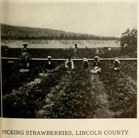
      Orchard Valley, a district entirely devoted to fruit culture, is situated near the mouth of Hawk creek.  In this it resembles the farms along the Columbia and Spokane river bottoms.  Orchard Valley, in common with these river fruit farms, comprises sandy bottom lands, more than one thousand feet below the upland wheat fields, that can lie irrigated and will produce almost every variety of fruit aside from those of a purely tropical nature.  Each recurrent season the Orchard Valley fruit farmers ship car-loads of strawberries, apples, peaches, and pears.  The first crop of strawberries is marketable in June and July; in October a second crop matures.  These fruit farms are all irrigated, and the land is valuable.  A few acres of fruit-bearing orchard are all that one man, or the average-sized family can successfully manage.  The Orchard Valley bottom, on which some forty families reside, resembles a large village.  There is yet considerable fruit land along the river and canyon bottoms, more elevated and difficult to irrigate than the improved farms lower down, but in time this, too, will be supplied with irrigating ditches, and planted to fruits and berries.  These fruit farmers are in comfortable circumstances.  Their land has become quite valuable.  A large portion of the fruit product is shipped to Spokane and other outside points at a distance.  Peaches usually retail on the market from 50 to 60 cents per box, apples from 50 to 95 cents, prunes from 40 to 50 cents per crate, plums from 40 to 75 cents, pears from 50 to 90 cents and for
strawberries the producer generally receives $1.50 per crate.

________________________

194


      The last half dozen years has witnessed the greatest development in the fruit industry of Lincoln county.  Mr. Robert Neal was the first to engage in it about fifteen years ago, on the Columbia river.  Not many years since the Orchard Valley flat was an open waste on which horses and cattle ranged the year round.  It is, and was then, a beautiful spot.  It overlooked the river and was sheltered on both sides by timbered hills and grassy glades, over which roamed large bands of horses and cattle.  Its beauty has been still further enhanced by elegant homes and fruitful orchards — scenes of thrift and enterprise.  In the midst of this Elysian scene is a fine school house building, and though it is situated several miles from a railroad the community is supplied with a telephone system connecting them with the surrounding towns and cities.  Altogether it is one of the most prosperous and happy neighborhoods in the county.

      Nearly all the rich bottom lands along the Spokane and Columbia rivers and the deep canyons that lead down to them from the upland prairies are devoted, almost exclusively, to the cultivation of apples, pears, peaches, plums, apricots, cherries, strawberries, blackberries, etc., and these lands are very valuable.  The river channels lie about one thousand feet below the level of the prairie land, the descent in many places being quite steep, and occasionally the slopes are covered with forests and brush.  In ether places the hillsides are rocky and rough, and again the descent is formed by a series of plateaus, or terraces, covered with more or less timber or brush, over which stock ranges both summer and winter, the locality once being the retreat of deer and other wild animals.

      Concerning the cultivation of fruit the Northern Pacific Bulletin says in 1897, and quite conservatively:
      While Lincoln county has never claimed to be a fruit country (which statement would not at present be borne out by the evidence), there is hardly a farm to be found which has been occupied for any length of time, which does not possess its orchard sufficient not only for supplying the wants of its owners, but also to enable him to add to his income by sale of fruit.  Certain localities are especially famous for their fruit, the warm, sandy river bottoms where irrigation can be easily applied, being utilized almost exclusively in this direction. *  *  *  As many as 10,000 quarts of strawberries have been taken off a single acre.  Lincoln county is especially famous for its apples, which possess keeping qualities of a very high order. It is not unusual to find Ben Davis apples and Newton pippins from Lincoln county on the markets in good condition in June and July.  Aside from its grain and fruits the county is noted for its dairy products, the native grass being extremely nutritious, while alfalfa is a very profitable crop.  Poultry, also, is raised quite successfully, and the farmers are learning that the poultry yard can be counted upon to furnish a very considerable addition to their revenues.  The farmer who knows how to handle bees is also sure of a handsome income from this source.
      It is interesting to watch the evolution of any new county.  Each successive year it presents a new aspect.  The editor of the Lincoln County Times thus describes that portion of the county under consideration lying between Sprague and Davenport, as it appeared in 1888:
      The road runs up hill and down, the face of the country everywhere being decidedly undulating.  On the rounded summits of the hills one can see far off, north, east and west, over vast stretches of the same hilly prairie.  On the southern horizon lies the long, pine timber belt.  This woody district terminates about ten miles east of Sprague.  The highest elevation surmounted during our drive from Sprague to Davenport affords a pleasant view down the valley of Crab creek, and also into Lord's Valley

________________________

195

which, it is claimed, is the finest agricultural region in this vicinity.  On the far northern horizon, 60 or 70 miles distant, you see the blue summits of the mountains lying north of the Big Bend of the Columbia river, between the mouths of the Spokane and Okanogan rivers.  The prospect affords a striking impression of an immense fertile region, rich in possibilities for agricultural development and very sparsely occupied as yet by settlers.  All this region belongs to what is known throughout the state of Washington under the general name of the 'Big Bend Country.'  It contains more good land still in possession of the United States government, and open to homestead entry, and preemption claims, than can be found in any other region west of the Rocky Mountains.
      Surprising, indeed, is the change that has taken place in the physical aspect of Lincoln county since the above lines were written.  Sixteen years have elapsed and there is no more government land open to homestead entry.  The absence of settlers noted has been supplied with a thrifty class of solid, substantial farmers, and the wide waste of rolling prairie — virgin soil — is now dotted with farm houses, cattle and orchards.  It is a transformation worthy the enterprise and business sagacity of the inhabitants of Lincoln county, and one upon which it is good for the eye of man to dwell.

________________________

________________________
Wednesday, February 1, 2012

BIG BEND p. 580: OTHER TOWNS

________________________

________________________

570 (continued)


BRIDGEPORT.

      Bridgeport is located near the northern part of the county near the junction of Foster Creek with the Columbia river.  It is favorably situated to command the trade of the surrounding country.  It lies fifty miles northeast of Waterville.

      Business men of Bridgeport, Connecticut, were largely interested in building the town.  It was proposed to make Bridgeport a commercial center for the northern part of Douglas county.  The town was platted November 30, 1891, by Butler Liversay.  Quite substantial improvements were made in the spring of 1892.  Energy and enterprise, backed by unlimited capital were at work to make Bridgeport a city worthy of the name.  The principal streets were graded and a steam ferry was put on the river.  The peculiar configuration of the ground where the new town was located made it appear that the expected railroad to the Okanogan country would be compelled to build to the town and cross the Columbia near this point.  It was expected at this time that the Northern Pacific railway was about to build to the Okanogan country.  The forks of Foster Creek at this point converge as they reach the Columbia and afford a natural and feasible highway for a railway.  At the mouth of the creek is a long and level plateau, and here it was that the new town was laid out.

      The company responsible for the establishment of Bridgeport was the Western Land & Improvement Association.  The store of Boyd Teter was opened for business in July, 1893.  Shortly after the inauguration of the town of Bridgeport some trouble arose in connection with financial matters which came perilously near causing an abandonment of the project.  August 2, 1892, a correspondent writing from Bridgeport said:
      The new town of Bridgeport is again on
________________________

581
the top wave of excitement.  The townsite company dug up a few thousands and paid off the brick yard contractors and hands.  The outside walls of the brick hotel are up, about four feet, and a raft of lumber is expected this week.  Teams are busy hauling lumber, iron, etc, from Coulee City for the steam ferry boat that is to make daily runs from Bridgeport to Port Columbia, and all around is the busy hum of an embryo city.
      In January, 1894, Bridgeport consisted of the big, $15,000 hotel, one store, the postoffice and a newspaper.  During the summer of 1894 F. J. Eitel put in operation a brick flouring mill with a capacity of from 75 to 100 barrels a day.

      While Bridgeport did not succeed in becoming the city that its builders intended, it has, since its establishment, been an important trading point for the rich country in which it is fortunately situated.  It is a thriving, prosperous town.  The census of 1900 accredited it with a population of no, which has been materially increased.  The religious denominations comprise Presbyterian and Methodist churches.


QUINCY

      Is located on the Great Northern railway, thirty-two miles east of Wenatchee.  Until the latter part of 1901 Quincy was simply a siding on the Great Northern.  The Big Bend Chief of December 27, 1901, said of this place:
      One of the towns to the west that is certain to be of some importance in the near future is the siding on the Great Northern known as Quincy.  A. V. Swift, W. T. Nichols and Ray Crothers are interested in the development of the country thereabouts and report a large influx of population at that point in the last two months.
      The town was platted February 28. 1902, by Richard Coleman.  The following additions have been made:
      Richardson's First Addition, August 18,  1901, by David Richardson.
      Central Quincy, September 3, 1902, by Quincy Land & Improvement Company, by H. S. Kergsley, president, and Charles H. Ross, secretary.
      March 28, 1902, the Big Bend Chief said:
      A few weeks ago Quincy, Washington, was simply an unused sidetrack on the Great Northern, in the desert.  Now, however, the plain is taking on the appearance of a village and people are coming in and breaking up the bunch grass, preparatory to growing crops.  The town at present consists of a hotel under the management of R. Coleman, a general store in charge of J. Muellerleile, a hardware store conducted under canvas until lumber can be obtained, by John Stambaugh; a lumber yard and a livery stable in charge of R. Williams and D. C. Crosby represents the real estate end of the enterprise.  A petition has been in for some time for the establishment of a postoffice and it is expected that Quincy mail will be delivered from the railway within a month.
      In June, 1903, according to the returns of the county assessor, the census was 140, which entitled it to rank in company with Hartline, as the third town in the county in point of size, Waterville and Wilsoncreek only having larger populations.


EPHRATA.

      This town is situated on the Great Northern railway, 123 miles west of Spokane.  It has a bank, several warehouses, hotel and several general stores.  It was first settled in September, 1901.  Ephrata is beautifully located on a high flat, with ample drainage in three directions.  With an excellent spring one-fourth of a mile from the railway station the town is abundantly supplied with clear, cold water.  For many years stockmen used the site where now stands Ephrata as a camping ground in time of roundups, on account of the water in that vicinity.

________________________

582

At that period the place was known as Beasley Springs.  The townsite was platted July l0, 1901, by Jesse Cyrus.  The following additions have been made:
      Cyrus' First Addition, September 9, 1901, by Jesse Cyrus.
      Cyrus' Second Addition, September 9, 1901, by Jesse Cyrus.
      Third Addition, May 31, 1902, by Jesse Cyrus.
      Although Ephrata did not gain much of a standing as a town until 1902, for several years before that period it had been quite a grain shipping point.  Then the rush of settlers to the "south country" changed the condition of affairs in this neighborhood, and a town of considerable importance made its appearance as if by magic.  The following relating to the early history of the place is taken from the Big Bend Chief of July 18, 1902:
      Ephrata is one of the new towns to the west which betoken marked improvement.  Eighteen month ago Uncle Jesse Cyrus, the 'Farther of Ephrata,' was sleeping securely in his cabin, free from cares and worriments more common to neighbors in a village.  But immigration came thick and fast to this neck of the Big Bend and last summer he found it was necessary to plat a town.  Even then Mr. Cyrus was doubtful whether his tranquility was greatly to be disturbed, with his stock, and located as he is, with a beautiful spring of water at his door, he had arranged to irrigate sufficient land to provide feed for his stock through the winter; had planted an orchard for his own use, and contracted to supply the railroad company with water.  But the little plat of ground soon passed into the hands of tradesmen, and as if by magic a town sprung up with all its tributary evils and advantages.  Uncle Jesse, although he had come to believe he would pass his days in comparative solitude at the foot of the bunch grass hill, was not slow to get himself in line with the march of progress and some months ago he installed a system of water works by means of which he could serve the purest water in the second stories of the buildings in the village, and now in addition to his other duties he makes his monthly round and collects the rent.
      In June, 1903, the population of Ephrata, according to the returns of the assessor, was 87.  Since then these figures have been materially increased.


KRUP.

      About six miles east of Wilsoncreek, on the Great Northern railway, and just within the boundaries of Douglas county, is located the pleasant little town of Krupp.  Situated as it is in the valley of the beautiful stream known as Crab Creek, surrounded by most picturesque scenery, it presents a pleasing sight to one who has ascended the westerly divide and pauses to take a survey of the little town nestling in the valley below.  Krupp is in the center of a grain and cattle country which guarantees for the future a good and increasing business.  Here the first settler who ever came into Douglas county located away back in 1871.

      Impressed with the idea that as the country filled up there must be a place where the surrounding settlers might market their products and purchase their supplies, George Urquhart, who for many years had made his home on this spot, platted the town of Krupp July 14, 1902.  He gave it his earnest support in its development.  The first business house in the new town was a general store erected in the summer of 1901 by F. A. Windgate.  It was platted July 14, 1902, by George Urquhart.  The population in June, 1903, as reported by the assessor was only 45, but the past year has witnessed a wonderful improvement.


DOUGLAS.

      Five miles southeast of Waterville, on the Waterville-Coulee City stage road, is the little town of Douglas, a village of about 75 population.  The business houses of this town

________________________

583

comprise a general store, a hardware and implement store, a feedmill and two blacksmith shops.  One church graces the place, of the German Lutheran faith.

      Douglas is one of the oldest towns in the county, and at one time occupied a position of importance in a political and commercial way.  It was in 1884 that the site of Douglas was taken up as a place of residence by Ole Dale. In 1886 the townsite of Douglas was platted and the town entered the race for the county seat honors, and polled a number of votes.  It is claimed that Douglas would have become the commercial center of the western Big Bend country and occupied the position now enjoyed by Waterville, had it not been for the over-confidence and nearsighted policy of the townsite proprietors.  The first business enterprise in Douglas was a blacksmith shop instituted by Henry Thompson in the fall of 1885.  In 1887 a general store was opened by S. Barnhart and the same year O. O. Wright put in a drug store, afterward for many years engaging in the general merchandise business.  Following the county seat removal from Okanogan, and when that town had become but a memory, its place was taken by Douglas, and in 1887 it fell heir to the Okanogan postoffice.

      Douglas is situated at the intersection of the Ritzville and Spokane Falls road, and was the nearest route from Ellensburg to the Salmon River mines of the Okanogan country.  The rush to those mines in 1887-88 made the little town of Douglas an important one as a stopping point.  Sunday morning, October 11, 1891, fire destroyed the general merchandise store of O. O. Wright.  It was with great difficulty that the entire town was saved from destruction, owing to the prevailing heavy gale.  The loss was about $4,000, insurance being carried for about one-half the loss.


STRATFORD.

      This Shakesperian hamlet is located on the Great Northern railway, eight miles west of Wilsoncreek.  Of this village the Big Bend Empire of date of September 16, 1897, said:
      J. C. Atwood, Leonard F. Spear and many other settlers upon the public lands in township 22, north ranges 27, and 28 east, on the line of the Great Northern railway in Douglas county, Washington, have petitioned the Fourth Assistant Postmaster General for the establishment of a postoffice at Stratford station, to be known as Stratford, and for the appointment of Swen Kerr, of that place as postmaster.  The nearest office at the present time is on the Great Northern railway at Wilsoncreek, eight miles east of Stratford station.  The only other postoffice in that section of the county is at Coulee City, twenty miles north, and there is no wagon road between Coulee City and Stratford station.
      The petition states that owing to the rapid construction of the Co-operative Company's irrigating ditch, and the consequent irrigation of the land there is certain to be a large community at Startford in the near future.  Some of the signers of the petition live at a place known as Adrian, and these are compelled to travel sixteen miles for their mail.  There is no wagon road, and they are obliged to follow the most convenient route along the railroad.  For two months, this year, it is stated, these settlers could secure their mail at the Wilsoncreek postoffice only by crossing the flooded streams on railroad bridges.  For these reasons immediate action has been urged on the part of the postoffice department.
      William Stevens was the pioneer merchant of Stratford and he was alone until the summer of 1902, when Young Brothers put in a store and lumber yard.  J. T. Gollehon also established a lumber yard a few months before the Young Brothers.  In 1903 Mr. Gollehon also built a hotel.  Moore & Company are proprietors of a livery stable, blacksmith shop, flour and feed store and implement warehouse, all of which might be termed "diversified

________________________

584

commercialism."  A fine church has been erected and a number of dwellings completed.

      The town of Stratford was platted January 17, 1903, by J. T. Young.


ORONDO.

      Riverview Postoffice, or as it is more generally called, Orondo, is a little town on the Columbia river, ten miles southwest of Waterville.  This is a landing for the steamers which ply the Columbia river and is Waterville's port of entry.  Stages meet all boats and several trips a day are made between the river town and Waterville.  At Orondo are a general store, a hotel and three grain warehouses.  But the Orondo which enters more particularly into this history was the one a mile and a half above the present place, and which, at one period, was heavily boomed.

      The townsite of Orondo, "the town which held the key," was platted by J. B. Smith, June 10, 1887.  It was laid out along the river front.  The streets were First, Second, Third and Fourth, and the avenues were Riverside, Orondo and Columbia.  The first addition to Orondo was platted May 19, 1888, by Mr. Smith.  The second addition, May 29, 1889, by the same party.  The following is the copy of an advertisement which appeared in the Big Bend Empire February 16, 1888, showing that this Orondo was to be no common town:
      Orondo has a boom in town lots and the era of building and industrial development has commenced to call that attention to her natural position and advantages that she is entitled to as the coming commercial and industrial emporium of the Big Bend.  A glance at the map of Washington Territory will convince the eagle eye of the business man that Orondo holds the key to the future of great magnitude.  A history of the Big Bend cannot be written without Orondo unlocking her stores of wealth contained in the rolling water of the mighty Columbia river in her long journey from the Rocky Mountains to the Pacific Ocean.  A line drawn eastward from Puget Sound, near the Sixth Standard Parallel, will pass almost directly through Seattle, Orondo, Davenport and Spokane Falls, the four depots of industry that stand at the gateways of Puget Sound, the Columbia river and the Rocky Mountains that by virtue of their natural positions will control the commerce and manufactures of Central Washington.
      Orondo is located on the east bank of the Columbia river, about one and one-half miles below the confluence of the Entiat river with the same, and is within five miles of the great wheat fields of the Big Bend.  Her gardens will produce peaches, grapes, tomatoes, apples, pears, sweet potatoes and peanuts in semitropical luxuriance.  Her splendid water power is now being improved so that power will be furnished for a roller mill to grind the flour of the Big Bend and the new steamer can transport it to the Salmon River mines and the upper country.  The majestic cedars of the upper Columbia and the aspiring pines and firs of the Columbia and its tributaries can be sawn into lumber and manufactured into windows, doors, tubs, pails, furniture, pen holders, matches, etc., etc., while the wool of the thousands of sheep that graze on the hills can be manufactured into fabrics to keep the people warm.
      The ore of the miner can be crushed and smelted and manufactured into implements of industry and the uses of man.  It is contemplated to furnish water from the Columbia river to the citizens of Orondo to drink and irrigate their gardens.  These are a few of the industrial fields open to practical men.  Orondo was laid out in July, 1887, and already the proprietor has disposed of a half interest in the water power, and 150 town lots.  A store has been running full blast for a few months, a hotel is to be built in the early spring and the water power is now being improved.  A new steamer is to run from Rock Island to near the
________________________

585
Salmon mines in the spring.  Power and lots will be rented or sold for industrial and other purposes.  For further information call on or write to J. B. Smith, Orondo, Badger Postoffice, Douglas county, Washington Territory.
      A later advertisement in the Empire stated that "a warehouse, newspaper, flouring mill, tannery and blacksmith shop were to be added to her store."

      The altitude of Orondo, being only 665 feet above the ocean, the climate is grand and the productions almost semi-tropical — the growing of tobacco, sweet potatoes and peanuts has been fully tested with success, and the plum, prune, apricot, pear, cherry, grape, peach and apple mature to perfection without irrigation.

      In 1899 a rival town was started at what was known as McMillan's Landing, and called Riverview.  A correspondent in the Empire of January 25, 1900, facetiously wrote that "the booming new town of Riverview has caught up with Orondo — has three inhabitants and two vacant buildings."


RIVERVIEW.

      About all that can be said of this place is embraced in the following:  The postofiice was established in 1901.  By order of the department it was removed from Orondo and the name changed.  J. H. Mason is postmaster.


PORT COLUMBIA.

      All towns which come into existence do not succeed in becoming the metropolis which their sanguine promoters plan.  Some, in fact, are very short lived, but their brief careers often contain a modicum of history.  Such a place was Port Columbia.  July 23, 1891, the Big Bend Empire said:
      A company styling itself the Port Columbia Townsite & Land Company has recently been organized.  Its capital stock is $25,000, all of which is taken.  It officers are H. W. Bonne, president; Walter Gerson, secretary ; J. P. Carvette, treasurer.  These gentlemen are from Spokane.  Frank R. Loucks, of Waterville, is general manager.  The directors are H. W. Bonne, Walton Gerson, and I. W. Matthews, the latter also of Waterville.  This company has purchased 400 acres of land on the banks of the Columbia river, about 40 miles from Waterville, and propose to there start a town to be called Port Columbia.  The site chosen is opposite the mouth of the Okanogan river, on a long stretch of the south side of the Columbia river basin.  They have put over $8,000 in cash into the enterprise and evidently mean businenss.  Eighty acres is to be platted and cut up into business lots, the plat to be filed this week and the property put on the market at once.  The company claims they have reserved eight blocks for a railroad at the request of the railroad officials; that they will build a $3,000 hotel in about a month; that Port Columbia will be the Columbia river terminus for the steamboat now being built by Birch Brothers, for Okanogan river service; that they will build a road to Central Ferry and also put in a propeller ferry at the town landing, and lastly that they have building stone directly south of the proposed townsite.  They say further that that portion of their land which abutts the river is subirrigated, and as fine land as there is in the world.
      Port Columbia was platted July 24, 1891, by H. W. Bonne, Walter Gerson and I. W. Matthews, trustees Port Columbia Townsite & Land Company.  Columbia Park Addition was platted December 28, 1891, by Ella Manntell, and Mantell's Riverside Addition, by Ella Mantell, the same date.


OTHER TOWNS.

      Adrian is fifteen miles west of Wilsoncreek, on the line of the Great Northern railway, the junction of the Great Northern and the Adrian-Coulee City cut-off.  It is simply a station containing a few railroad buildings.

________________________

586

      Bonita is a new postoffice in the northern part of the county.

      Hammond is another new office and flag station across the Cohimbia river from Rock Island.

      Pittsburg postoffice has recently been established in the southern part of the county, across the line from Lind, Adams county.  Mr. Peters is postmaster.

      Barry Postoffice is on the Columbia river in the northwestern portion of the county, 65 miles northeast of Waterville, and 35 miles northwest of Wilbur, which is its shipping point.  It has one general store.

      Brays is a postoffice at a landing on the Columbia river, 12 miles northwest of Waterville.  It is a grain shipping point.

      Bright is a country postoffice between Grand and Moses Coulees, 25 miles southeast of Waterville, and 17 miles north of Ephrata.

      Dye Postoffice is 38 miles northeast of Waterville, and 8 miles west of Bridgeport.  There are many other postoffices scattered throughout the county, in fact, Douglas county is very conveniently supplied with postal facilities.

      Rock Island is a flag station on the Great Northern railway, where it crosses the Columbia river eleven miles southeast of Wenatchee.  In 1892-3 Rock Island was a town of considerable importance and for a time supported several stores and other enterprises.  For a few weeks a newspaper was published at this point.  These lively times in Rock Island's history were due to the building of the railroad and the bridge across the Columbia river.  Prior to the construction of the bridge the trains were ferried across the river by a steamer, the Nixon. In the spring of 1893 the mammoth bridge was completed and the first train crossed on Thursday, May 2, of that year.  This event marked the downfall of the town of Rock Island.  The laborers who had been employed at this point moved away and the business houses were discontinued.  J. E. Keane was the founder and proprietor of the once flourishing town.

________________________


________________________

BIG BEND p. 577: WILSONCREEK


________________________


________________________

577 (continued)


WILSONCREEK.

      Wilsoncreek is the second town in size in Douglas county.  Aside from Waterville it is the only one incorporated.  It is on the Great Northern railroad, a minor freight division point of that line.  Here are located an eleven-stall round-house, a large coal chute and other buildings common to railroad division.  Some of these buildings were erected in the early 90's, shortly after the advent of the road.  It was many years later before the town of Wilsoncreek came into existence.  While there was much homestead land in other portions of Douglas county, that lying along Crab and Wilson Creeks was not considered worthy of being termed farm land.  But the rush of immigration in 1902 induced people to examine these lands, then experiment, and the result was that the land was discovered to be "agricultural" in every sense of the word.  Towns became numerous throughout the south country and Wilsoncreek easily distanced all competitors.
      A postoffice was established in December, 1894.  Previous to this the stock men of Douglas county were compelled to go to Lind, in Adams county, for their mail.  Concerning the earlier history of Wilsoncreek, the Big Bend Chief, of December 27, 1901, said:
      Some three years ago, (1898) one Moltke, (whether he was a relation of the late count is not certain) was induced to open a small store
________________________

578
near where Gentry & Goldsmith's lumber yard now stands. It is said that there were various articles of merchandise and stomach bitters for sale there.  W. T. is an authority for the statement that one bottle of those bitters was sufficient to make a man steal from one pocket and put it in another.  However, the count sold the shop to one Sanders who, in turn, disposed of it to R. L. Playfair.  Playfair thought it a white elephant and coaxed Nichols Brothers to take it off from his hands.  The Nichols Brothers closed out to G. D. Miller.  In the meantime George Swanson had opened up a merchandising store just west of the bank.
      Practically, this was the inception of Wilsoncreek. Almost the entire trade of the pioneer store was from the neighboring stockmen and cowboys.  Old timers tell us of the high jinks of the "buckaroo," at the place where the town now stands.  The gaming table was the principal recreation and money and bitters flowed as free as water.  On January 1, 1900, seven people would complete the census of Wilsoncreek.  One small store sufficed to more than supply the demands of the adjacent country, and the Wilsoncreek hotel had recently been completed by William Blanchard.  The guests were like angels' visits, few and far between.  But they soon became more numerous.  According to the United States census taken at that time the population was 26.  With the opening of the year 1901 Wilsoncreek consisted of a school house, one small store, the Wilsoncreek hotel and the Great Northern buildings.
      The town was platted January 31, 1901, by Robert L. Playfair.  The following additions have since been made.
      Playfair's First Addition, April 3, 1902, by R. L. Playfair.
      Taggart Addition, April 1, 1902, by W. H. O'Larey, F. E. Taggart and A. A. Mclntyre.
      First Addition, September 10, 1902, by Jesse Gentry and A. A. Goldsmith.
      Schroeder's College Addition, October 25, 1902, by J. P. Schroeder.
      School lot addition, April 25, 1903, by Zack Finney, W. H. O'Leary, Julius L. Stuart, directors, and A. J. Miles, clerk.
      Urquhart's First Addition, August 12, 1903, by Donald Urquhart.
      October 20, 1901, the Big Bend Chief said:
      A train load of immigrants from Jackson county, Minnesota, came to Wilsoncreek.  Some of these engaged in business in the town and the majority settled on land in the vicinity.  This was the signal for a big growth of the town.  At this time there were in the village only a part of the Douglas hotel building, the old Wilsoncreek hotel, Stapp's restaurant, three stores, Goldsmith & Bagley's, G. D. Miller's and the People's Trading Company (Swanson Brothers), a blacksmith shop, butcher shop, the Big Bend Land Office, R. J. Armstrong's livery stable and two saloons, Gentry & Goldsmith's and Finney & Patees' lumber yards.
      But the last two months of the year 1901 witnessed a marvelous growth in Wilsoncreek.  The Chief stated that during the month of November and December sixty actual residents were added to the town and many others took up residence in the surrounding country.
      Friday night, January 20, 1902, fire destroyed the coal chutes of the Great Northern railway, causing considerable loss to the company.  The fire originated near the west end of the chutes and within ten minutes the entire structure was a mass of seething flames.  Six car-loads were standing on the track near by, together with two cars of lumber.  All were burned.  This was a serious disaster, yet the destruction of these chutes marked the beginning of considerable improvement in the railroad buildings at Wilsoncreek. Another conflagration is thus described by the Big Bend Chief of date August 29, 1902.
      Wilsoncreek's most disastrous fire occurred last Friday morning, (August 22d). At 3 :45 o'clock, just as No. 16 was pulling into the yards the engineer noticed what looked like a bright light in the general store of J. H. Benson.
________________________

579
It flamed up, and he blew the whistle to awaken the people.  Many heard it but supposed it was for cattle rather than a fire. Nightwatchman, William Astell saw it about the same time and when the watchman and Engineer Dygon reached the store the lower floor seemed a mass of flames.  J. H. Benson and wife were in Seattle, and E. E. Benson, Mrs. Miller, Miss Grant and J. H. Benson's little son were sleeping over the store.  They barely escaped in their night clothes.  E. E. Benson had taken the precaution to convey the books to his room and saved them, but forgot to take a wallet which he had placed under his pillow.  William Lair and Watchman Astell made the rounds and awakened the citizens.  As quickly as possible every one in the village was at work.  The flames soon spread on the east to the drug store of Lee Brothers, and but little of the stock was saved.  P. J. Wegele's pump establishment was the next to go, but nearly all the stock and tools were taken off before the fire reached it.  Strenuous efforts were then made to save the livery stable and shed across the street and with wet blankets and water this was accomplished.  The Wilsoncreek hotel, occupied by Dr. J. M. Corpening and owned by A. V. Swift, was also burned with the shack just back of it, which was the property of Thomas Kemp.  To the west of Benson's store the war against the flames was just as fiercely waged.  G. D. Miller succeeded in saving about $1,000 worth of his stock, and Maltbie, Friel & Maltbie managed to remove close to $800 worth of their hardware stock before the fire ran them out.  J. W. Emmert's dwelling was the next to go, but the household goods had all been taken out before the fire had reached the house.  Then came the tug of war with the bank.  Albert Nelson stood in the hottest of it throwing water when older men had failed.  With prompt and constant work the fire was held here, but Mr. Swanson, the cashier, had succeeded in removing all of his household goods and everything of value in the bank had been put into the vault or moved across the street to places of safety. It was a wild time, and by 5 :30 o'clock a. m., there was not a stick left standing in the burned district.
      Every possible effort was made to save the buildings and the citizens did good work in rescuing stock from the flames.  Jesse Gentry and J. F. Moore stood at their posts in R. J. Armstrong's shed with wet blankets on their heads to permit them to work at all.  A. A. Goldsmith and A. V. Swift were on top of the livery barn, while scores of men, boys, women and girls were carrying water so soon as the bulk of the stocks had been got to safety.  At the bank Albert Nelson, Floyd Miller, Sam Fader and many others were fighting the flames with all their strength and cunning.  They all unite in giving Mr. Nelson credit for saving the bank building, as he seemed not to feel the scorching heat which was driving others back.  The losses of this fire are as follows:
      J. W. Emmert, house and carpets, about $500, with insurance of $300 on house and $400 on furniture.
      Joseph Mitchell, building, $750, no insurance.
      Maltbie, Freil & Maltbie, stock $2,500, with insurance of $1,000.
      Nichols Brothers, building, $600, no insurance.
      G. D. Miller, stock, $3,000, with insurance of $1,000.
      J. H. Benson, building, household furniture and stock, $6,850, with insurance of $2,300.
      Lee Brothers, building, stock and fixtures, $3,300, with insurance of $2,375.
      P. J. Wegele, building, $300, with insurance of $200.
      A. V. Swift, the old Wilsoncreek hotel building, $350, no insurance.
      The rapidity with which the town recovered from this serious disaster is thus voiced by a correspondent:
Wilsoncreek merchants are rustlers.  This
________________________

580
is well illustrated by the rapidity with which the business men who were burned out by the big fire of August 22d, have rebuilt their places of business.  Every merchant who shared in the $20,000 loss only a month ago, is now doing business at the old stand, but in a more commodious structure.
      The first steps toward incorporation were taken at a mass meeting held February 23, 1903.  It was almost unanimously decided to arrange for a special election to vote on the proposition.  A committee consisting of A. A. Goldsmith, J. H. Benson, W. H. O'Larey, R. H. Lee, and L. M. Dow was named to circulate a petition. It received 67 signers.  The county commissioners granted the request of the petition and named April 24th as the day for holding said election.  There were 49 votes cast with the following result:
      For incorporation, 40; against, 3.
      For Mayor — G. F. Goldsmith, 40; B. E. Butler, 1.
      For Councilman — J. W. Emmert, 45; D. O. Freil, 47; W. H. O'Larey, 45; A. A. Goldsmith, 41; R. H. Lee, 22 ; William Newlove, 27; Jesse Gentry, 2; P. J. Wegele, 2; William Schumacher, 1.
      For Treasurer — A. J. Swanson, 42.
      The first meeting of the newly elected city council was held April 28th.  The incorporation of Wilsoncreek at this time illustrates the swiftness which marks the growth of western towns.  Two years prior Wilsoncreek consisted of a postoffice, a depot and one residence.
      The population in June, 1903, according to the returns of the assessor, was 246. The educational facilities include a handsome, four-room brick school house erected at a cost of $7,000 during the summer of 1903.  There is one Presbyterian church edifice. The fraternal societies are represented by the Royal Neighbors of America, Modern Woodmen of America and the Foresters.

________________________


________________________